
Mezquíriz topographic map
Interactive map
Click on the map to display elevation.
About this map
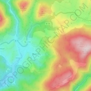
Name: Mezquíriz topographic map, elevation, terrain.
Location: Mezquíriz, Erro, Pirineo, Navarra, España (42.95078 -1.41441 42.98676 -1.37234)
Average elevation: 890 m
Minimum elevation: 725 m
Maximum elevation: 1,096 m
Other topographic maps
Click on a map to view its topography, its elevation and its terrain.