
Thank you for supporting this site ❤️
Make a donation
Make a donation
Gear up for your next adventure:
As an Amazon Associate, this site earns from qualifying purchases at no extra cost to you.
Kishrak topographic map
Click on the map to display elevation.
Thank you for supporting this site ❤️
Make a donation
Make a donation
Gear up for your next adventure:
As an Amazon Associate, this site earns from qualifying purchases at no extra cost to you.
About this map
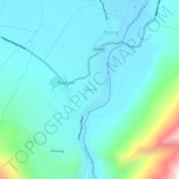
Name: Kishrak topographic map, elevation, terrain.
Location: Kishrak, Zanskar, Kargil District, Ladakh, 194302, India (33.44753 76.86449 33.48753 76.90449)
Average elevation: 3,669 m
Minimum elevation: 3,509 m
Maximum elevation: 4,466 m
Thank you for supporting this site ❤️
Make a donation
Make a donation
Gear up for your next adventure:
As an Amazon Associate, this site earns from qualifying purchases at no extra cost to you.