
Make a donation
Gear up for your next adventure:
As an Amazon Associate, this site earns from qualifying purchases at no extra cost to you.
Chavinillo topographic map
Click on the map to display elevation.
Make a donation
Gear up for your next adventure:
As an Amazon Associate, this site earns from qualifying purchases at no extra cost to you.
Chavinillo
Su relieve es accidentado con una altitud promedio de 3 600 msnm pues se emplaza dentro de la Cordillera Central de los Andes del norte peruanos. Su clima a esta altitud le corresponde de templado-frío a frío.
Make a donation
Gear up for your next adventure:
As an Amazon Associate, this site earns from qualifying purchases at no extra cost to you.
About this map
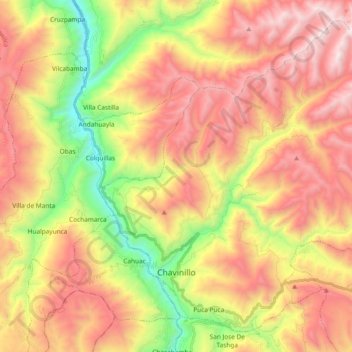
Name: Chavinillo topographic map, elevation, terrain.
Location: Chavinillo, Provincia de Yarowilca, Huánuco, Perú (-9.88988 -76.65011 -9.72687 -76.46320)
Average elevation: 3,856 m
Minimum elevation: 3,015 m
Maximum elevation: 4,622 m
Make a donation
Gear up for your next adventure:
As an Amazon Associate, this site earns from qualifying purchases at no extra cost to you.