Geolocate

Thierbach topographic map

Click on the map to display elevation.

About this map

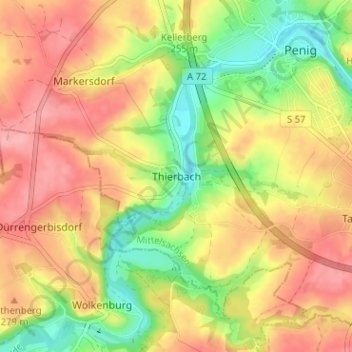
Name: Thierbach topographic map, elevation, terrain.

Location: Thierbach, Penig, Mittelsachsen, Sachsen, 09322, Deutschland (50.89880 12.66519 50.93880 12.70519)

Average elevation: 257 m

Minimum elevation: 202 m

Maximum elevation: 301 m

Gear up for your next adventure:

Bushcraft Tarp - Versatile emergency shelter or gear protection
🧣Evaporative Cooling Towel - Beat the heat during intense summer climbs
🥾Trail Hiking Socks - Comfortable socks to prevent blisters and fatigue
Camping Essentials - All-in-one gear for a comfortable camping trip
🗺️Topographic Maps - Detailed maps to explore trails, mountains, and wilderness areas

As an Amazon Associate, this site earns from qualifying purchases at no extra cost to you.