
San Mateo Mountain topographic map
Interactive map
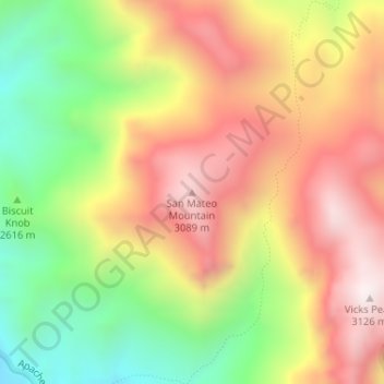
Click on the map to display elevation.
About this map
Name: San Mateo Mountain topographic map, elevation, terrain.
Average elevation: 2,731 m
Minimum elevation: 2,310 m
Maximum elevation: 3,119 m
Other topographic maps
Click on a map to view its topography, its elevation and its terrain.
Tokay
United States > New Mexico > Socorro County > Tokay
Tokay, Socorro County, New Mexico, United States
Average elevation: 1,546 m
Socorro
United States > New Mexico > Socorro County
Socorro, Socorro County, New Mexico, United States
Average elevation: 1,433 m