
Castañar topographic map
Click on the map to display elevation.
About this map
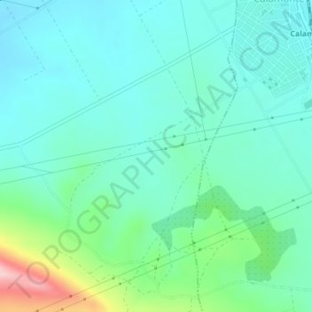
Name: Castañar topographic map, elevation, terrain.
Location: Castañar, Mérida, Badajoz, Extremadura, 06810, España (38.86535 -6.40999 38.88535 -6.38999)
Average elevation: 260 m
Minimum elevation: 213 m
Maximum elevation: 429 m
Other topographic maps
Click on a map to view its topography, its elevation and its terrain.
Río Guadiana
España > Extremadura > Mérida
Una de sus múltiples fuentes, la que le otorga su nombre, se configura en la provincia española de Ciudad Real, en el manantial de los Ojos del Guadiana, situado en el término municipal de Villarrubia de los Ojos, a 608 m de altitud. Uno de los ríos que fluyen en su cabecera es el Guadiana Viejo,…
Average elevation: 222 m