Geolocate

Congo river topographic map

Click on the map to display elevation.

About this map

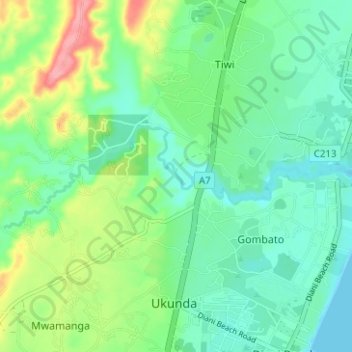
Name: Congo river topographic map, elevation, terrain.

Location: Congo river, Gombato, Kwale, Coastal Kenya, 40397, Kenya (-4.26803 39.53599 -4.24991 39.59873)

Average elevation: 30 m

Minimum elevation: -1 m

Maximum elevation: 103 m

Gear up for your next adventure:

🎒Hiking Backpack - Lightweight and ergonomic backpacks for day hikes or multi-day treks
❄️Traction Ice Cleats - Slip-on spikes for icy trails and winter hiking
🛁Quick-Dry Microfiber Towel - Space-saving towel that dries rapidly on the move
🔦LED Flashlight - Powerful and long-lasting flashlight for camping and emergencies
🧦Thermal Socks - Warm socks for winter hiking or camping

As an Amazon Associate, this site earns from qualifying purchases at no extra cost to you.