
Thank you for supporting this site ❤️
Make a donation
Make a donation
Gear up for your next adventure:
As an Amazon Associate, this site earns from qualifying purchases at no extra cost to you.
Bharatpur topographic map
Click on the map to display elevation.
Thank you for supporting this site ❤️
Make a donation
Make a donation
Gear up for your next adventure:
As an Amazon Associate, this site earns from qualifying purchases at no extra cost to you.
About this map
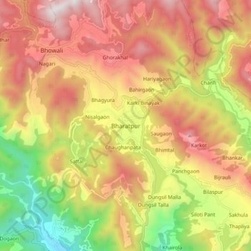
Name: Bharatpur topographic map, elevation, terrain.
Location: Bharatpur, Nainital, Uttarakhand, 263136, India (29.31824 79.50788 29.39824 79.58788)
Average elevation: 1,447 m
Minimum elevation: 677 m
Maximum elevation: 2,102 m
Thank you for supporting this site ❤️
Make a donation
Make a donation
Gear up for your next adventure:
As an Amazon Associate, this site earns from qualifying purchases at no extra cost to you.