
Sarıoğlan topographic map
Interactive map
Click on the map to display elevation.
About this map
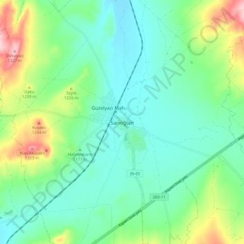
Name: Sarıoğlan topographic map, elevation, terrain.
Location: Sarıoğlan, Kayseri, Zentralanatolien, 38820, Türkei (39.03706 35.92725 39.11706 36.00725)
Average elevation: 1,189 m
Minimum elevation: 1,134 m
Maximum elevation: 1,335 m