
Thill topographic map
Interactive map
Click on the map to display elevation.
About this map
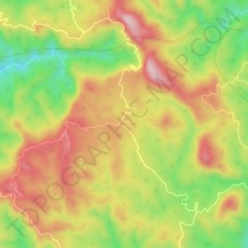
Name: Thill topographic map, elevation, terrain.
Location: Thill, Khundian, Kangra, Himachal Pradesh, 176030, Inde (31.93516 76.36707 31.97516 76.40707)
Average elevation: 844 m
Minimum elevation: 681 m
Maximum elevation: 986 m