
Sprundel topographic map
Interactive map
Click on the map to display elevation.
About this map
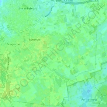
Name: Sprundel topographic map, elevation, terrain.
Location: Sprundel, Rucphen, Nordbrabant, Niederlande (51.50809 4.57567 51.55434 4.64011)
Average elevation: 10 m
Minimum elevation: 4 m
Maximum elevation: 16 m
Other topographic maps
Click on a map to view its topography, its elevation and its terrain.
Schijf
Niederlande > Nordbrabant > Rucphen
Schijf, Rucphen, Nordbrabant, Niederlande
Average elevation: 12 m