
Thank you for supporting this site ❤️
Make a donation
Make a donation
Gear up for your next adventure:
As an Amazon Associate, this site earns from qualifying purchases at no extra cost to you.
Panchgani topographic map
Click on the map to display elevation.
Thank you for supporting this site ❤️
Make a donation
Make a donation
Gear up for your next adventure:
As an Amazon Associate, this site earns from qualifying purchases at no extra cost to you.
About this map
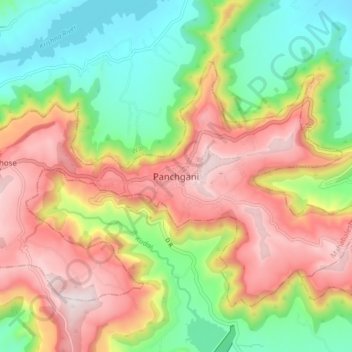
Name: Panchgani topographic map, elevation, terrain.
Location: Panchgani, Mahabaleshwar, Satara, Maharashtra, 412805, India (17.88395 73.75927 17.96395 73.83927)
Average elevation: 1,019 m
Minimum elevation: 726 m
Maximum elevation: 1,353 m
Thank you for supporting this site ❤️
Make a donation
Make a donation
Gear up for your next adventure:
As an Amazon Associate, this site earns from qualifying purchases at no extra cost to you.