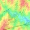
Raleigh topographic map
Click on the map to display elevation.
Raleigh
Raleigh is located in the northeast central region of North Carolina, where the Piedmont and Atlantic coastal plain regions meet. This area is known as the "fall line" because it marks the elevation inland at which waterfalls begin to appear in creeks and rivers. As a result, most of Raleigh features gently rolling hills that slope eastward toward the state's flat coastal plain.
About this map
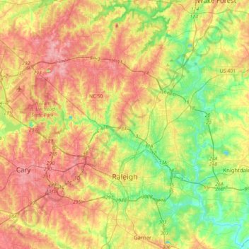
Name: Raleigh topographic map, elevation, terrain.
Location: Raleigh, Wake County, North Carolina, United States (35.70826 -78.81897 35.97074 -78.47079)
Average elevation: 103 m
Minimum elevation: 44 m
Maximum elevation: 167 m
Other topographic maps
Click on a map to view its topography, its elevation and its terrain.


Harris Lake County Park
United States > North Carolina > Wake County > Hollemans Crossroads
Average elevation: 75 m
Lake Johnson
United States > North Carolina > Wake County > Raleigh > Orchards
Average elevation: 121 m
Prestonwood Soccer Complex
United States > North Carolina > Wake County > Cary
Average elevation: 111 m
Lake Raleigh
United States > North Carolina > Wake County > Raleigh > Isle Forest
Average elevation: 104 m