
Thank you for supporting this site ❤️
Make a donation
Make a donation
Gear up for your next adventure:
As an Amazon Associate, this site earns from qualifying purchases at no extra cost to you.
Besteiros topographic map
Click on the map to display elevation.
Thank you for supporting this site ❤️
Make a donation
Make a donation
Gear up for your next adventure:
As an Amazon Associate, this site earns from qualifying purchases at no extra cost to you.
About this map
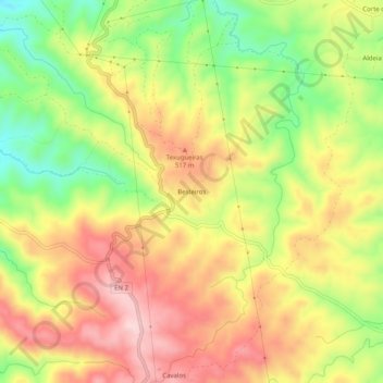
Name: Besteiros topographic map, elevation, terrain.
Location: Besteiros, Ameixial, Loulé, Faro, 8100-050, Portugal (37.31410 -7.97661 37.35410 -7.93661)
Average elevation: 449 m
Minimum elevation: 312 m
Maximum elevation: 569 m
Thank you for supporting this site ❤️
Make a donation
Make a donation
Gear up for your next adventure:
As an Amazon Associate, this site earns from qualifying purchases at no extra cost to you.