
Thank you for supporting this site ❤️
Make a donation
Make a donation
Gear up for your next adventure:
As an Amazon Associate, this site earns from qualifying purchases at no extra cost to you.
Perafita topographic map
Click on the map to display elevation.
Thank you for supporting this site ❤️
Make a donation
Make a donation
Gear up for your next adventure:
As an Amazon Associate, this site earns from qualifying purchases at no extra cost to you.
About this map
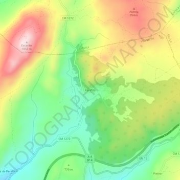
Name: Perafita topographic map, elevation, terrain.
Location: Perafita, Vila Verde, Alijó, Vila Real, 5090-031, Portugal (41.36851 -7.56295 41.40851 -7.52295)
Average elevation: 797 m
Minimum elevation: 622 m
Maximum elevation: 1,022 m
Thank you for supporting this site ❤️
Make a donation
Make a donation
Gear up for your next adventure:
As an Amazon Associate, this site earns from qualifying purchases at no extra cost to you.