
L'Ardoise topographic map
Interactive map
Click on the map to display elevation.
About this map
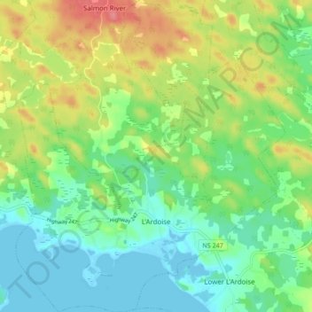
Name: L'Ardoise topographic map, elevation, terrain.
Average elevation: 27 m
Minimum elevation: -2 m
Maximum elevation: 75 m
Other topographic maps
Click on a map to view its topography, its elevation and its terrain.
Fourchu
Canada > Nouvelle-Écosse > Municipality of the County of Richmond
Fourchu, Municipality of the County of Richmond, Richmond County, Nouvelle-Écosse, Canada
Average elevation: 5 m