
Thank you for supporting this site ❤️
Make a donation
Make a donation
Gear up for your next adventure:
As an Amazon Associate, this site earns from qualifying purchases at no extra cost to you.
Rocanville topographic map
Click on the map to display elevation.
Thank you for supporting this site ❤️
Make a donation
Make a donation
Gear up for your next adventure:
As an Amazon Associate, this site earns from qualifying purchases at no extra cost to you.
About this map
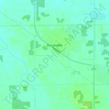
Name: Rocanville topographic map, elevation, terrain.
Location: Rocanville, Division No. 5, Saskatchewan, S0A 3L0, Canada (50.37264 -101.70779 50.38745 -101.67291)
Average elevation: 523 m
Minimum elevation: 518 m
Maximum elevation: 529 m
Division No. 5 trails, hiking, mountain biking, running and outdoor activities
Thank you for supporting this site ❤️
Make a donation
Make a donation
Gear up for your next adventure:
As an Amazon Associate, this site earns from qualifying purchases at no extra cost to you.