
Xinning topographic map
Interactive map
Click on the map to display elevation.
About this map
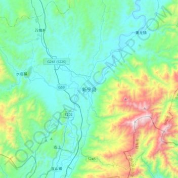
Name: Xinning topographic map, elevation, terrain.
Location: Xinning, Xinning County, Shaoyang, Hunan, China (26.27708 110.69186 26.59708 111.01186)
Average elevation: 638 m
Minimum elevation: 274 m
Maximum elevation: 1,965 m
Other topographic maps
Click on a map to view its topography, its elevation and its terrain.
Fuyi River
China > Hunan > Xinning County > Taishang
Fuyi River, Taishang, Xinning County, Shaoyang, Hunan, China
Average elevation: 314 m