Geolocate

Kamrej topographic map

Click on the map to display elevation.

About this map

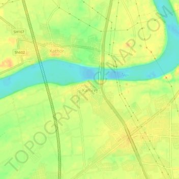
Name: Kamrej topographic map, elevation, terrain.

Location: Kamrej, Kamrej Taluka, Surat District, Gujarat, 394180, India (21.25978 72.92827 21.29978 72.96827)

Average elevation: 19 m

Minimum elevation: -1 m

Maximum elevation: 31 m

Gear up for your next adventure:

🧣Merino Neck Gaiter - Protects against wind, sun, and cold at high altitudes
🚲Heavy Duty Bike Lock - Secure your bike at the trailhead or during stops
🚑Survival Whistle - Signal for help across long distances in mountains
🧥Fleece Jacket - Warm and lightweight jacket for layering
Camping Groundsheet - Protect your tent from moisture and dirt

As an Amazon Associate, this site earns from qualifying purchases at no extra cost to you.