Geolocate

Santa Fe topographic map

Click on the map to display elevation.

About this map

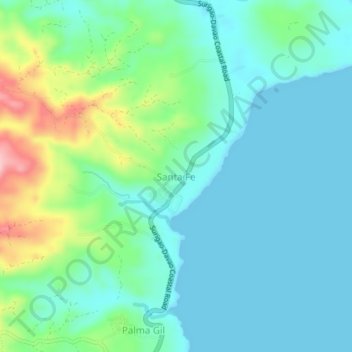
Name: Santa Fe topographic map, elevation, terrain.

Location: Santa Fe, Caraga, Davao Oriental, Davao Region, Philippines (7.35926 126.53590 7.39926 126.57590)

Average elevation: 39 m

Minimum elevation: 0 m

Maximum elevation: 168 m

Gear up for your next adventure:

🪑Insulated Seat Pad - Protect your seat from cold rocks and wet logs
🦟Insect Repellent - Keep mosquitoes and black flies away in wooded areas
🧼Biodegradable Camp Soap - Environmentally friendly cleaning for gear and body
🛶Kayak Dry Bag - Waterproof storage for kayaking adventures
🥾Hiking Shorts - Breathable shorts suitable for summer hikes

As an Amazon Associate, this site earns from qualifying purchases at no extra cost to you.