Geolocate

Galas River topographic map

Click on the map to display elevation.

About this map

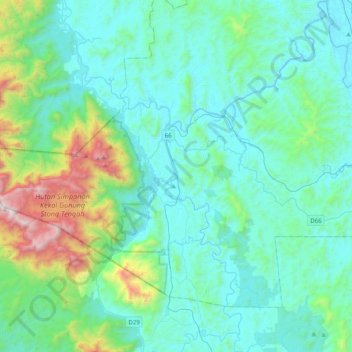
Name: Galas River topographic map, elevation, terrain.

Location: Galas River, Dabong, Kuala Krai, Kelantan, Malaysia (5.12404 102.00525 5.52193 102.18970)

Average elevation: 297 m

Minimum elevation: 19 m

Maximum elevation: 1,738 m

Gear up for your next adventure:

🥫Freeze-Dried Meals - Lightweight, high-calorie nutrition for multi-day treks
🔪Outdoor Multitool - Versatile tool for repairs and food prep in the wild
🛶Kayak Dry Bag - Waterproof storage for kayaking adventures
🥾Hiking Gaiters - Protect legs and shoes from mud, snow, and debris
🦶Anti-Blister Balm - Prevents friction and hotspots during long ascents

As an Amazon Associate, this site earns from qualifying purchases at no extra cost to you.