Geolocate

93105 topographic map

Click on the map to display elevation.

About this map

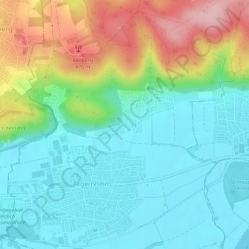
Name: 93105 topographic map, elevation, terrain.

Location: 93105, Tegernheim, Landkreis Regensburg, Bavaria, Germany (49.03141 12.17920 49.03151 12.17930)

Average elevation: 380 m

Minimum elevation: 324 m

Maximum elevation: 504 m

Gear up for your next adventure:

🧶550 Survival Paracord - Versatile utility cord for emergency repairs and rigging
🥾Trail Hiking Socks - Comfortable socks to prevent blisters and fatigue
🧥Waterproof Jacket - Lightweight rain jackets for hiking and outdoor activities
❄️Traction Ice Cleats - Slip-on spikes for icy trails and winter hiking
🧥Packable Rain Jacket - Breathable waterproof layer for unpredictable weather

As an Amazon Associate, this site earns from qualifying purchases at no extra cost to you.