Geolocate

Agutaya topographic map

Interactive map

Click on the map to display elevation.

About this map

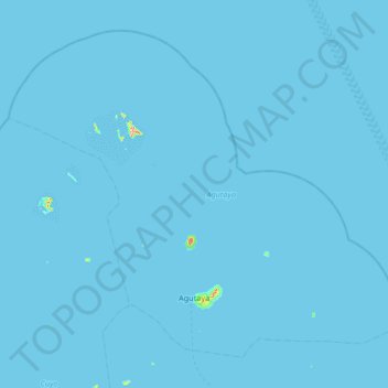
Name: Agutaya topographic map, elevation, terrain.

Location: Agutaya, Palawan, Mimaropa, 5320, Philippines (11.05096 120.62093 11.60087 121.28635)

Average elevation: 0 m

Minimum elevation: 0 m

Maximum elevation: 255 m

Other topographic maps

Click on a map to view its topography, its elevation and its terrain.

Alimanguan

Philippines > Palawan > Roxas

Average elevation: 23 m

Cuyo

Philippines > Palawan

Cuyo Island is the largest island of the Cuyo Archipelago, about 13 kilometres (8.1 mi) long, 7.5 kilometres (4.7 mi) wide, and with an area of 57 square kilometres (22 sq mi). Mount Bonbon with an elevation of 817 ft (249 m) is the highest mountain in Cuyo island. The Island is under the jurisdiction of the…

Average elevation: 0 m

Aborlan

Philippines > Palawan

Average elevation: 13 m

Bacuit Bay

Philippines > Palawan

Average elevation: 0 m

Puerto Princesa

Philippines > Palawan > Puerto Princesa

Average elevation: 92 m

Pass Island

Philippines > Palawan > Busuanga

Average elevation: 20 m

Palawan

Philippines > Palawan

Average elevation: 8 m

Cataban

Philippines > Palawan > Cataban

Average elevation: 79 m

Busuanga Island

Philippines > Palawan

Average elevation: 33 m