
Barrio Jucanyá topographic map
Interactive map
Click on the map to display elevation.
About this map
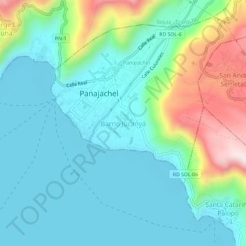
Name: Barrio Jucanyá topographic map, elevation, terrain.
Location: Barrio Jucanyá, Panajachel, Sololá, 07010, Guatemala (14.71719 -91.17190 14.75719 -91.13190)
Average elevation: 1,679 m
Minimum elevation: 1,546 m
Maximum elevation: 2,089 m
Other topographic maps
Click on a map to view its topography, its elevation and its terrain.
Panajachel
Guatemala > Sololá > Panajachel
Panajachel, Sololá, 07010, Guatemala
Average elevation: 1,860 m