Geolocate

Lasserre topographic map

Click on the map to display elevation.

About this map
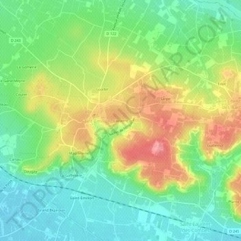
Name: Lasserre topographic map, elevation, terrain.

Location: Lasserre, Saint-Émilion, Libourne, Gironde, Nouvelle-Aquitaine, France métropolitaine, 33330, France (44.87313 -0.17023 44.91313 -0.13023)

Average elevation: 51 m

Minimum elevation: 11 m

Maximum elevation: 110 m

Other topographic maps

Click on a map to view its topography, its elevation and its terrain.

Gear up for your next adventure:

💡Compact LED Flashlight - Powerful and portable flashlight for outdoor use
☕Camping Coffee Maker - Brew fresh coffee anywhere on the topographic map
🧢Hiking Hat - Sun-protective and breathable hats for long treks
⛺Camping Tent - Weather-resistant tents suitable for 2 to 6 people
👟Leg Gaiters - Keep debris, mud, and snow out of your boots

As an Amazon Associate, this site earns from qualifying purchases at no extra cost to you.