Geolocate

Gavín topographic map

Click on the map to display elevation.

About this map

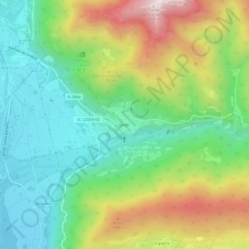
Name: Gavín topographic map, elevation, terrain.

Location: Gavín, Biescas, Alto Gállego, Huesca, Aragón, 22639, España (42.59943 -0.31666 42.63943 -0.27666)

Average elevation: 1,122 m

Minimum elevation: 821 m

Maximum elevation: 1,662 m

Gear up for your next adventure:

🥾Approach Shoes - Shoes designed for climbing approaches and rugged trails
📷Outdoor Action Camera - Capture high-elevation views and rugged adventures
🦶Hiking Shoe Insoles - Added support for high arches and long days on feet
🧤Thermal Hiking Gloves - Grip-enhanced gloves for cold-weather altitude trekking
🥾Light Trekking Boots - Supportive boots for multi-day treks

As an Amazon Associate, this site earns from qualifying purchases at no extra cost to you.