
Ripa topographic map
Click on the map to display elevation.
About this map
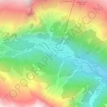
Name: Ripa topographic map, elevation, terrain.
Location: Ripa, Macugnaga, Verbano-Cusio-Ossola, Piemonte, 28876, Italia (45.94787 7.94211 45.98787 7.98211)
Average elevation: 1,811 m
Minimum elevation: 1,186 m
Maximum elevation: 2,698 m
Other topographic maps
Click on a map to view its topography, its elevation and its terrain.
Ghiacciaio del Belvedere
Italia > Piemonte > Verbano-Cusio-Ossola > Macugnaga
Average elevation: 2,214 m