Geolocate

Pratapgad topographic map

Click on the map to display elevation.

About this map

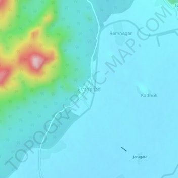
Name: Pratapgad topographic map, elevation, terrain.

Location: Pratapgad, Arjuni Morgaon Taluka, Gondiya, Maharashtra, India (20.77095 80.10216 20.81095 80.14216)

Average elevation: 273 m

Minimum elevation: 234 m

Maximum elevation: 535 m

Gear up for your next adventure:

🥾Hiking Shoes - Durable and comfortable shoes for trail hiking
💡Portable Camping Lamp - Rechargeable lamp for campsite lighting
Camping Essentials - All-in-one gear for a comfortable camping trip
👟Leg Gaiters - Keep debris, mud, and snow out of your boots
🥤Collapsible Travel Cup - Saves space and weight in your mess kit

As an Amazon Associate, this site earns from qualifying purchases at no extra cost to you.