Geolocate

Cabezo topographic map

Click on the map to display elevation.

About this map

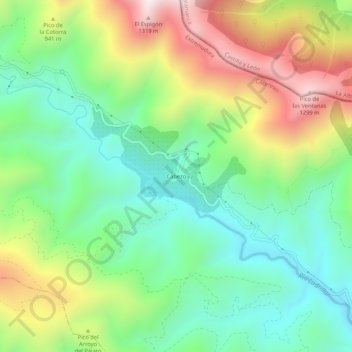
Name: Cabezo topographic map, elevation, terrain.

Location: Cabezo, Ladrillar, Cáceres, Extremadura, 10624, Spain (40.42912 -6.20789 40.46912 -6.16789)

Average elevation: 784 m

Minimum elevation: 465 m

Maximum elevation: 1,330 m

Gear up for your next adventure:

🛏️Camping Sleeping Mat - Comfortable mats for sleeping outdoors
💧Hydration Pack - Hands-free hydration system for long hikes
🥾Trail Hiking Shoes - Durable shoes designed for rugged trails
🦟Insect Repellent - Keep mosquitoes and black flies away in wooded areas
🥾Hiking Gaiters - Protect legs and shoes from mud, snow, and debris

As an Amazon Associate, this site earns from qualifying purchases at no extra cost to you.