
Palomeque topographic map
Interactive map
Click on the map to display elevation.
About this map
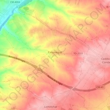
Name: Palomeque topographic map, elevation, terrain.
Location: Palomeque, La Sagra, Toledo, Castilië-La Mancha, Spanje (40.09334 -4.01741 40.14343 -3.93893)
Average elevation: 610 m
Minimum elevation: 512 m
Maximum elevation: 660 m