Geolocate

Cauldon topographic map

Click on the map to display elevation.

About this map
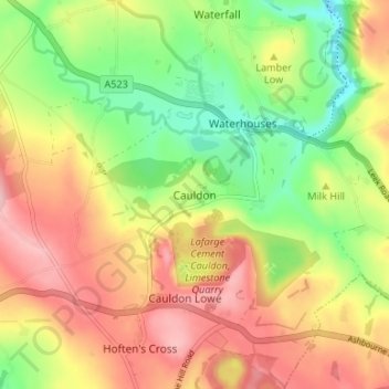
Name: Cauldon topographic map, elevation, terrain.

Location: Cauldon, Staffordshire Moorlands, Staffordshire, England, ST10 3EL, United Kingdom (53.02220 -1.90447 53.06220 -1.86447)

Average elevation: 283 m

Minimum elevation: 198 m

Maximum elevation: 366 m

Other topographic maps

Click on a map to view its topography, its elevation and its terrain.

Gear up for your next adventure:

🪜Heavy Duty Carabiners - Multi-use clips for securing gear to your backpack
🧥Packable Rain Jacket - Breathable waterproof layer for unpredictable weather
🛶Kayak Accessories - Essential gear for safe and fun kayaking adventures
🧭GPS Handheld Device - Reliable GPS navigation for outdoor adventures
🥾Light Trekking Boots - Supportive boots for multi-day treks

As an Amazon Associate, this site earns from qualifying purchases at no extra cost to you.