
Thank you for supporting this site ❤️
Make a donation
Make a donation
Gear up for your next adventure:
As an Amazon Associate, this site earns from qualifying purchases at no extra cost to you.
Suido topographic map
Click on the map to display elevation.
Thank you for supporting this site ❤️
Make a donation
Make a donation
Gear up for your next adventure:
As an Amazon Associate, this site earns from qualifying purchases at no extra cost to you.
About this map
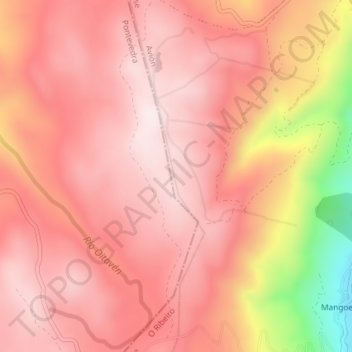
Name: Suido topographic map, elevation, terrain.
Location: Suido, Abelenda, Avión, O Ribeiro, Ourense, Galiza, Espanha (42.37443 -8.32696 42.39443 -8.30696)
Average elevation: 891 m
Minimum elevation: 536 m
Maximum elevation: 1,019 m
Thank you for supporting this site ❤️
Make a donation
Make a donation
Gear up for your next adventure:
As an Amazon Associate, this site earns from qualifying purchases at no extra cost to you.