Geolocate

Avlon topographic map

Click on the map to display elevation.

About this map

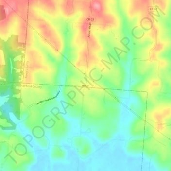
Name: Avlon topographic map, elevation, terrain.

Location: Avlon, Perry County, Ohio, 43150, United States (39.72396 -82.40488 39.76396 -82.36488)

Average elevation: 283 m

Minimum elevation: 240 m

Maximum elevation: 340 m

Gear up for your next adventure:

🔭Outdoor Binoculars - Lightweight binoculars for birdwatching and hiking
🧥Softshell Jacket - Windproof and breathable jacket for hiking
🔥Camping Stove - Portable stoves to cook outdoors with ease
💡LED Camping Lantern - Illuminate your campsite with long-lasting lanterns
🥾Hiking Leggings - Comfortable leggings for outdoor activities

As an Amazon Associate, this site earns from qualifying purchases at no extra cost to you.