Geolocate

Dimi topographic map

Click on the map to display elevation.

About this map

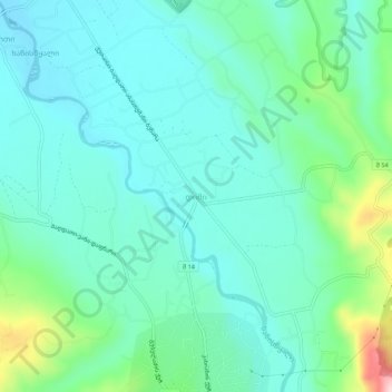
Name: Dimi topographic map, elevation, terrain.

Location: Dimi, Baghdati Municipality, Imereti, Georgia (42.07536 42.80157 42.11536 42.84157)

Average elevation: 200 m

Minimum elevation: 139 m

Maximum elevation: 423 m

Gear up for your next adventure:

Camping Essentials - All-in-one gear for a comfortable camping trip
🥾Durable Hiking Shoes - Long-lasting shoes for frequent hiking
🥾Waterproof Hiking Boots - Essential footwear for rugged terrain and wet Canadian trails
👟Leg Gaiters - Keep debris, mud, and snow out of your boots
🪑Insulated Seat Pad - Protect your seat from cold rocks and wet logs

As an Amazon Associate, this site earns from qualifying purchases at no extra cost to you.