
KG Atzgersdorf topographic map
Interactive map
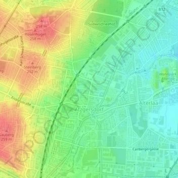
Click on the map to display elevation.
About this map
Name: KG Atzgersdorf topographic map, elevation, terrain.
Location: KG Atzgersdorf, Liesing, Vienne, 1230, Autriche (48.13779 16.28038 48.16236 16.31506)
Average elevation: 223 m
Minimum elevation: 198 m
Maximum elevation: 260 m
Other topographic maps
Click on a map to view its topography, its elevation and its terrain.