Geolocate

Mabuhay topographic map

Click on the map to display elevation.

About this map

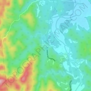
Name: Mabuhay topographic map, elevation, terrain.

Location: Mabuhay, Mahaplag, Leyte 5th District, Leyte, Eastern Visayas, 6512, Philippines (10.53452 124.93460 10.57452 124.97460)

Average elevation: 105 m

Minimum elevation: 43 m

Maximum elevation: 274 m

Other topographic maps

Click on a map to view its topography, its elevation and its terrain.

Gear up for your next adventure:

🥾Hiking Shoes - Durable and comfortable shoes for trail hiking
🥾Approach Boots - Comfortable boots for hiking and climbing approaches
🧭Orienteering Kit - Tools for map reading and navigation in the wild
🥾Mountaineering Boots - Supportive boots for climbing and high-altitude hiking
🔨Vehicle Emergency Tool - Safety tool for remote road trips to trailheads

As an Amazon Associate, this site earns from qualifying purchases at no extra cost to you.