
Hoffman topographic map
Click on the map to display elevation.
About this map
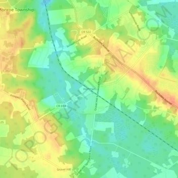
Name: Hoffman topographic map, elevation, terrain.
Average elevation: 35 m
Minimum elevation: 13 m
Maximum elevation: 58 m
Other topographic maps
Click on a map to view its topography, its elevation and its terrain.
Clearbrook Park
United States > New Jersey > Middlesex County > Monroe Township > Clearbrook Park
Average elevation: 38 m
Whittingham
United States > New Jersey > Middlesex County > Monroe Township > Half Acre
Average elevation: 45 m
Whittingham
United States > New Jersey > Middlesex County > Monroe Township > Half Acre
Average elevation: 45 m