Geolocate

Fairview topographic map

Click on the map to display elevation.

About this map

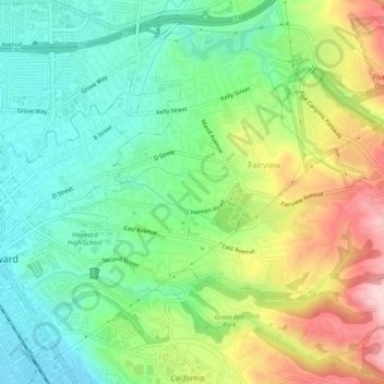
Name: Fairview topographic map, elevation, terrain.

Location: Fairview, Alameda County, California, 94540, United States (37.65576 -122.07290 37.69570 -122.02398)

Average elevation: 122 m

Minimum elevation: 19 m

Maximum elevation: 304 m

Gear up for your next adventure:

🧥Waterproof Hiking Jacket - Protect yourself from rain and wind while hiking
🥾Trail Hiking Socks - Comfortable socks to prevent blisters and fatigue
🥾Hiking Boots - Sturdy boots providing ankle support and traction on rugged trails
💡LED Headlamp - Hands-free illumination for night hiking and camping
❄️Traction Ice Cleats - Slip-on spikes for icy trails and winter hiking

As an Amazon Associate, this site earns from qualifying purchases at no extra cost to you.