
Thank you for supporting this site ❤️
Make a donation
Make a donation
Gear up for your next adventure:
As an Amazon Associate, this site earns from qualifying purchases at no extra cost to you.
Katni topographic map
Click on the map to display elevation.
Thank you for supporting this site ❤️
Make a donation
Make a donation
Gear up for your next adventure:
As an Amazon Associate, this site earns from qualifying purchases at no extra cost to you.
About this map
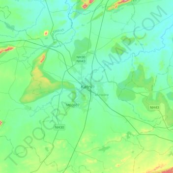
Name: Katni topographic map, elevation, terrain.
Location: Katni, Murwara Tahsil, Katni, Madhya Pradesh, 483500, India (23.67396 80.23246 23.99396 80.55246)
Average elevation: 399 m
Minimum elevation: 353 m
Maximum elevation: 610 m
Thank you for supporting this site ❤️
Make a donation
Make a donation
Gear up for your next adventure:
As an Amazon Associate, this site earns from qualifying purchases at no extra cost to you.