
Thank you for supporting this site ❤️
Make a donation
Make a donation
Gear up for your next adventure:
As an Amazon Associate, this site earns from qualifying purchases at no extra cost to you.
Sekigahara topographic map
Click on the map to display elevation.
Thank you for supporting this site ❤️
Make a donation
Make a donation
Gear up for your next adventure:
As an Amazon Associate, this site earns from qualifying purchases at no extra cost to you.
About this map
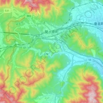
Name: Sekigahara topographic map, elevation, terrain.
Location: Sekigahara, Fuwa County, Gifu Prefecture, 503-1592, Japan (35.28748 136.40266 35.39526 136.50911)
Average elevation: 262 m
Minimum elevation: 22 m
Maximum elevation: 848 m
Thank you for supporting this site ❤️
Make a donation
Make a donation
Gear up for your next adventure:
As an Amazon Associate, this site earns from qualifying purchases at no extra cost to you.