Geolocate

Jesus Maria topographic map

Click on the map to display elevation.

About this map

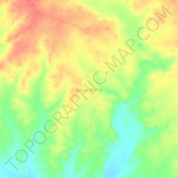
Name: Jesus Maria topographic map, elevation, terrain.

Location: Jesus Maria, Tambo Grande, Piura, Perú (-4.88749 -80.26704 -4.84749 -80.22704)

Average elevation: 125 m

Minimum elevation: 95 m

Maximum elevation: 149 m

Other topographic maps

Click on a map to view its topography, its elevation and its terrain.

Rio Piura

Perú > Piura > Tambo Grande > Tambogrande

Average elevation: 96 m

Gear up for your next adventure:

🔪Outdoor Multitool - Versatile tool for repairs and food prep in the wild
🔭Outdoor Binoculars - Lightweight binoculars for birdwatching and hiking
🧴Insect Repellent - Protect yourself from bugs during outdoor adventures
🧦Hiking Socks - Moisture-wicking and comfortable socks for long hikes
🪜Heavy Duty Carabiners - Multi-use clips for securing gear to your backpack

As an Amazon Associate, this site earns from qualifying purchases at no extra cost to you.