Geolocate

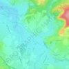
Le Creusot topographic map

Click on the map to display elevation.

About this map

Name: Le Creusot topographic map, elevation, terrain.

Location: Le Creusot, Autun, Saône-et-Loire, Bourgogne-Franche-Comté, Metropolitan France, 71200, France (46.78604 4.39013 46.82708 4.46111)

Average elevation: 376 m

Minimum elevation: 313 m

Maximum elevation: 516 m

Other topographic maps

Click on a map to view its topography, its elevation and its terrain.
Lavaux

France > Bourgogne-Franche-Comté > Saône-et-Loire > Dyo > Lavaux

Average elevation: 332 m

Gear up for your next adventure:

⛺Lightweight Backpacking Tent - Compact tent for efficient hiking trips
🥾Waterproof Hiking Boots - Boots keeping your feet dry in wet conditions
🥾Hiking Boots - Sturdy boots providing ankle support and traction on rugged trails
💧Collapsible Water Bottle - Space-saving water bottle for outdoor activities
🛌Down Sleeping Bag - Superior warmth-to-weight ratio for cold nights

As an Amazon Associate, this site earns from qualifying purchases at no extra cost to you.