Geolocate

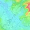
Le Creusot topographic map

Click on the map to display elevation.

About this map

Name: Le Creusot topographic map, elevation, terrain.

Location: Le Creusot, Autun, Saône-et-Loire, Bourgogne-Franche-Comté, Metropolitan France, 71200, France (46.78604 4.39013 46.82708 4.46111)

Average elevation: 376 m

Minimum elevation: 313 m

Maximum elevation: 516 m

Other topographic maps

Click on a map to view its topography, its elevation and its terrain.
Lavaux

France > Bourgogne-Franche-Comté > Saône-et-Loire > Dyo > Lavaux

Average elevation: 332 m

Gear up for your next adventure:

🥾Trekking Poles - Adjustable trekking poles to reduce knee stress and improve stability
🪑Insulated Seat Pad - Protect your seat from cold rocks and wet logs
🔦LED Flashlight - Powerful and long-lasting flashlight for camping and emergencies
🥾Waterproof Hiking Shoes - Durable shoes for wet and rugged trails
💧Hydration Bladder - Hands-free hydration solution for long treks

As an Amazon Associate, this site earns from qualifying purchases at no extra cost to you.