Geolocate

Ghorti topographic map

Click on the map to display elevation.

About this map

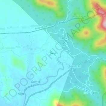
Name: Ghorti topographic map, elevation, terrain.

Location: Ghorti, Siroli, Satari, North Goa, Goa, India (15.59671 74.03912 15.63671 74.07912)

Average elevation: 73 m

Minimum elevation: 15 m

Maximum elevation: 374 m

Gear up for your next adventure:

🧥Insulated Jacket - Keep warm in cold outdoor conditions
🥽Outdoor Goggles - Protective eyewear for outdoor activities
🛶Canoe Life Vest - Safety vest for water sports
🧢Beanie Hat - Keep your head warm in cold weather
🥾All-Terrain Hiking Boots - Versatile boots for varied hiking conditions

As an Amazon Associate, this site earns from qualifying purchases at no extra cost to you.