Geolocate

McCordsville topographic map

Click on the map to display elevation.

About this map
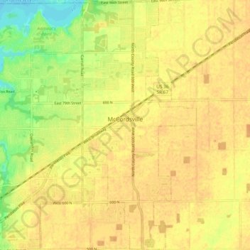
Name: McCordsville topographic map, elevation, terrain.

Location: McCordsville, Hancock County, Indiana, 46055, United States (39.85613 -85.93844 39.92824 -85.89520)

Average elevation: 259 m

Minimum elevation: 237 m

Maximum elevation: 268 m

Other topographic maps

Click on a map to view its topography, its elevation and its terrain.
Cleveland

United States > Indiana > Hancock County

Average elevation: 292 m

Gear up for your next adventure:

🧥Packable Rain Jacket - Breathable waterproof layer for unpredictable weather
🛁Quick-Dry Microfiber Towel - Space-saving towel that dries rapidly on the move
🪑Ultralight Camping Stool - Compact seating for rest stops during long hikes
🧦Crew Hiking Socks - Comfortable socks for long-distance hikes
🥾Waterproof Hiking Boots - Essential footwear for rugged terrain and wet Canadian trails

As an Amazon Associate, this site earns from qualifying purchases at no extra cost to you.