Geolocate

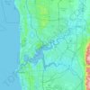
West Perth topographic map

Click on the map to display elevation.

About this map

Name: West Perth topographic map, elevation, terrain.

Location: West Perth, City of Perth, Western Australia, 6005, Australia (-31.97377 115.81787 -31.93644 115.85835)

Average elevation: 26 m

Minimum elevation: 0 m

Maximum elevation: 81 m

Other topographic maps

Click on a map to view its topography, its elevation and its terrain.
Kings Park

Australia > Western Australia > City of Perth > Perth

Average elevation: 31 m

Perth

Australia > Western Australia > City of Perth

Average elevation: 26 m

Perth

Australia > Western Australia > City of Perth

Perth, the capital of Western Australia, is situated on the Swan Coastal Plain, a flat expanse of sandy soil nestled between the Indian Ocean to the west and the Darling Scarp to the east. The Darling Scarp, also known as the Darling Range, is a low escarpment that extends north–south, marking a distinct…

Average elevation: 26 m

Gear up for your next adventure:

🥾Mountain Trail Shoes - High-traction shoes for mountain trails
⛺Camping Tent - Weather-resistant tents suitable for 2 to 6 people
🎒Backpack Rain Cover - External shield to keep your entire pack dry
🧭GPS Tracker - Track your location in remote areas safely
🧦Merino Wool Socks - Moisture-wicking comfort for long-distance hiking

As an Amazon Associate, this site earns from qualifying purchases at no extra cost to you.