
Großaltenstädten topographic map
Interactive map
Click on the map to display elevation.
About this map
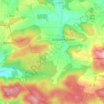
Name: Großaltenstädten topographic map, elevation, terrain.
Location: Großaltenstädten, Hohenahr, Lahn-Dill-Kreis, Hessen, Deutschland (50.63254 8.46326 50.67709 8.50578)
Average elevation: 341 m
Minimum elevation: 258 m
Maximum elevation: 438 m