
Chợ Lầu topographic map
Interactive map
Click on the map to display elevation.
About this map
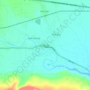
Name: Chợ Lầu topographic map, elevation, terrain.
Location: Chợ Lầu, Bắc Bình District, Binh Thuan province, Vietnam (11.18270 108.46572 11.26270 108.54572)
Average elevation: 18 m
Minimum elevation: -1 m
Maximum elevation: 99 m