
Perg topographic map
Interactive map
Click on the map to display elevation.
About this map
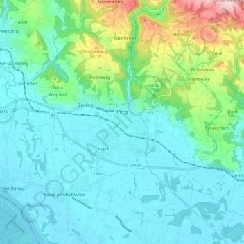
Name: Perg topographic map, elevation, terrain.
Location: Perg, Bezirk Perg, Haute-Autriche, 4320, Autriche (48.21871 14.58307 48.27521 14.69218)
Average elevation: 290 m
Minimum elevation: 234 m
Maximum elevation: 513 m