Geolocate

Front Royal topographic map

Click on the map to display elevation.

About this map

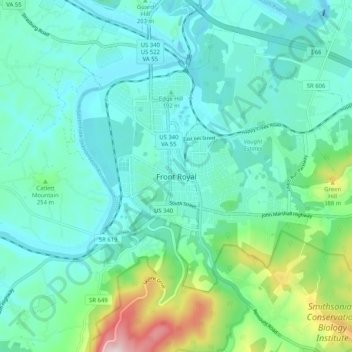
Name: Front Royal topographic map, elevation, terrain.

Location: Front Royal, Warren County, Virginia, United States (38.87785 -78.23177 38.95785 -78.15177)

Average elevation: 220 m

Minimum elevation: 132 m

Maximum elevation: 574 m

Gear up for your next adventure:

🧥Ultralight Puffy Jacket - Maximum warmth that packs down to the size of an orange
🥾Waterproof Hiking Boots - Essential footwear for rugged terrain and wet Canadian trails
🧳Compression Sacks - Maximize space in your backpack by shrinking gear
🔭Outdoor Binoculars - Lightweight binoculars for birdwatching and hiking
🥾All-Terrain Hiking Boots - Versatile boots for varied hiking conditions

As an Amazon Associate, this site earns from qualifying purchases at no extra cost to you.